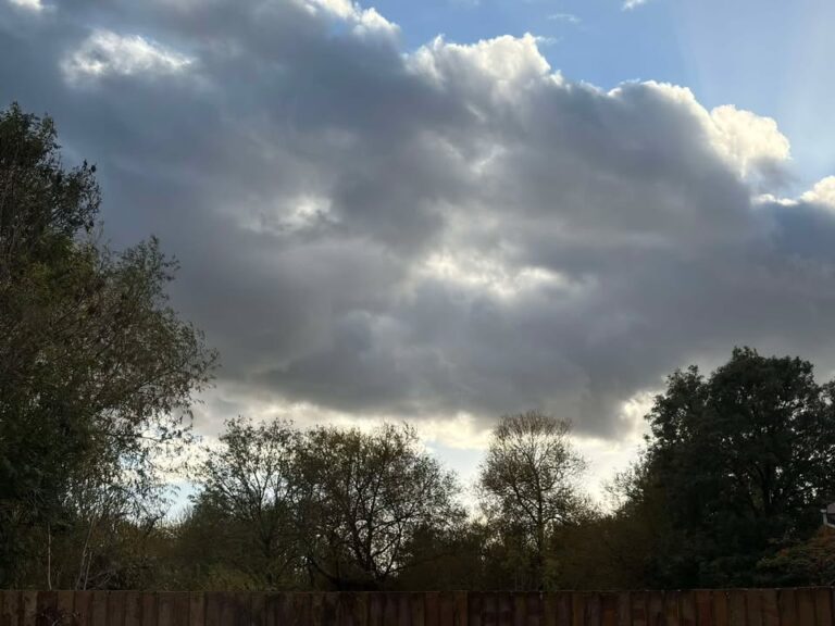
High pressure is back with another lengthy dry spell. And maybe some fog.
Thanks to Marilyn for the photograph.
So the general picture sees high pressure centred over Germany and keeping much of Europe dry and mild.
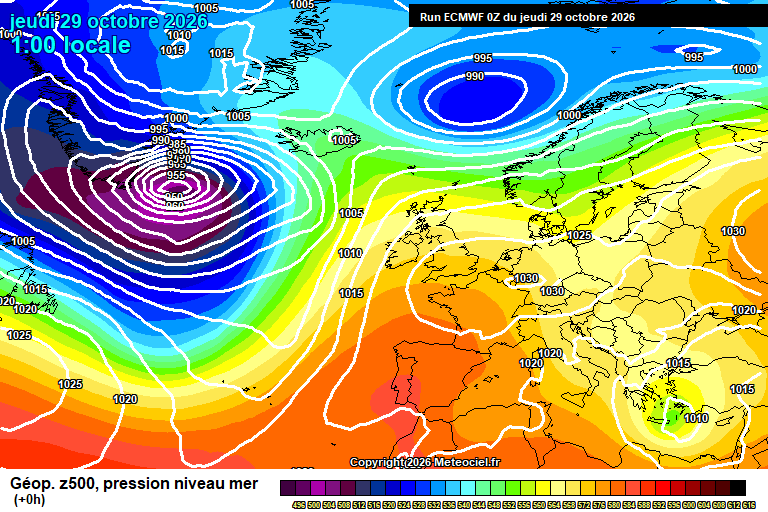
A cloudy start to Thursday, the cloud quite stubborn – it being late October it is harder for the sun to poke through (were it July, or even September it should be glorious and hot). But there should be some sunshine at times, more so this afternoon. Mild, 15’C. Clear skies for at least the first part of the night, some fog patches may form overnight – looks more likely further north than here. Down to around 7’C.
Friday will be a lovely, sunny day once any early mist/fog patches clear – just a bit of cloud around. Reaching 15’C, maybe even 16’C. Clear skies for at least the first half of the night, fog patches forming later in the night, but hit and miss as to where. Down to around 6’C.
Saturday probably starts with mist/fog/low cloud – once this clears during the morning we’ll see good sunny spells following, and a very pleasant day for the end of October. Reaching around 15’C. Fog likely forming in the evening and lasting overnight – it should be rather spooky. Down to around 6’C.
Sunday most likely starts foggy, but misty with low cloud if not. Probably the fog takes some time to lift, and it will stay mostly cloudy, with some drizzle possible – especially later in the day. Temperatures stuggling to around 10’C. Cloudy in the evening and at least first part of the night, some bits of light rain/drizzle around – skies tending to be clearer later, and down to around 5’C by dawn.
By Monday high pressure has shifted west towards Scotland bringing us a more easterly flow.
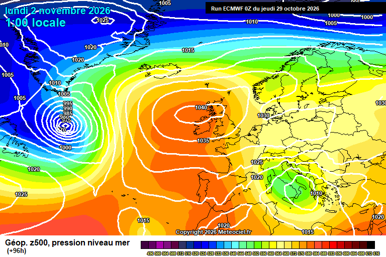
A mixture of sunny spells and cloudy spells, though likely more emphasis on the cloud. Perhaps a light shower in the breeze. Around 12’C. A mixture of cloudy spells and clear spells overnight, down to around 6’C.
Tuesday again probably a mixture of cloudy spells and sunny spells, with more emphasis on cloud. A light shower or bit of drizzle in the breeze possible. Around 12’C or so. Perhaps cloudier overnight with some drizzle.
High pressure likely remains in control for the rest of next week, probably close to our north so very similar conditions likely to prevail.
Broadly a mixture of sunny spells and cloudy spells, the cloudy spells could have a bit of drizzle mixed in but proper rain unlikely. Daytime temperatures roughly around 12’C, overnight somewhere between 5’C and 9’C depending on cloud amounts.
Probably a bit too much breeze for overnight fog, but cannot be ruled out yet.
Next weekend is more likely dry, perhaps a tad chiller but nothing unusual for November.
Where do we go after that?
Well, there’s a reasonable chance of a sudden stratospheric warming (SSW) event in around 7-10 days, still to be confirmed.
Statistically they significantly increase the chance of notable cold spells, the 2018 Beast From The East being a classic recent (ish) example.
However, we’ve had many more SSW events than normal in recent years, and none of them (to my recollection) have led to wintry weather for us.
If this one happens, it will be the earliest SSW on record by some distance. At the same time we have a record-breaking strength El Niño. Along with SSW events which no longer seem to cause the wintry weather they used to cause. On a year with record-breaking temperatures and heatwaves.
So…all I can say is much higher uncertainty than normal going forwards, and it will be fascinating to see how this winter turns out.
Until and if events dictate otherwise, I’m going to assume a return to wet and windy weather for the second half of November and into December, with the proviso that there is at least a small chance of a lengthy cold/wintry spell into December.
Have a pleasantly spooky end to the week.
Any comments?
No comments yet. Be the first to comment!