
Happy New Year everyone! We start the year with an Arctic plunge, and it will be notably cold, often sunny – and there could be a possible wintry surprise.
Thanks to Debbie for the photograph.
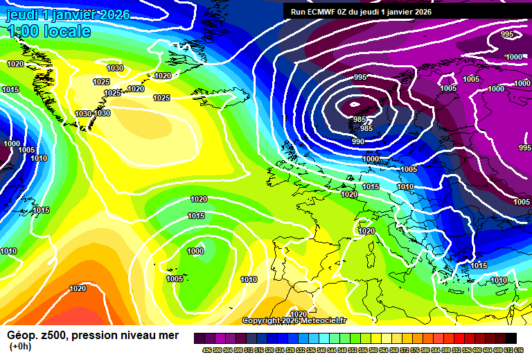
So we start the forecast period with high pressure to our northwest, towards Greenland/Iceland which then allows notably colder air to plunge down from the Arctic.
After a sunny start to New Year’s Day, a very weak weather front will spread south bringing more in the way of cloud, but quite high/mid-level so still generally bright with hazy sunshine most of the time. I cannot totally rule out a light shower, but it should remain dry. Around 6’C and becoming breezier. Fairly clear skies at first overnight, and colder, but a small feature will bring some showery rain/sleet and/or snow down from the north-west in the second half of the night. Some uncertainty on the exact dry, so it could stay dry – more likely something will fall, and it’s such a marginal call, my best guess is that a mixture of rain, sleet and snow will fall during the early hours – don’t be surprised if there is a slight covering of snow when you wake up, but definitely don’t expect it. Down to around 0’C before the feature arrives, around 2’C during. Possibly icy in places too…so do take care if out in the early hours.
Friday sees any early cloud with rain/sleet/snow mixtures clear quickly. There may well be ice and/or a slight covering of snow in places. Mostly sunny after, some bits of cloud around, reaching around 3’C, maybe 4’C – but will feel colder in the northerly breeze. Clear skies and frosty overnight, down to around -3’C.
Saturday starts frosty. It will be a mostly sunny day, some bits of cloud possible – but notably cold in the northerly breeze, around 2’C. The breeze easing overnight which will allow for a sharper frost, easily down to around -4’C quite widely, perhaps lower especially in more sheltered spots.
Sunday starts frosty. Again it will be mostly sunny, but temperatures will struggle to around 2’C at best. I cannot totally rule out a stray snow shower if a feature develops at some point – but feels like a 10% chance at best. Cold and frosty most likely overnight, down to around -4’C, give or take.
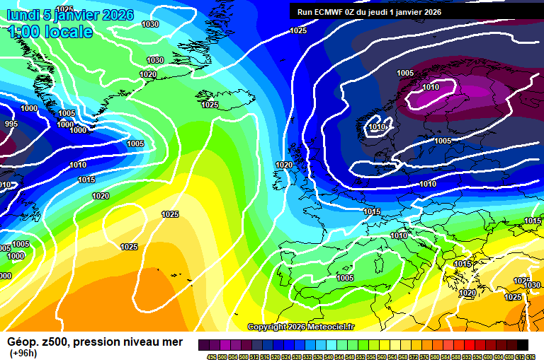
By Monday we are still in the Arctic flow, but the high pressure to the north-west will have sunk south, which will allow Atlantic weather systems to start to head our way – or at least try to.
Mostly similar weather, plenty of sunshine, some cloud around at times – and again I cannot totally rule out a wintry shower (more likely snow) if a feature develops and spreads inland, but again a 10% chance at best. Around 2’C. Most likely frosty overnight and down to around -4’C, perhaps lower.
Tuesday should remain cold and sunny, though probably increasingly hazy as a weather front tries to push in from the west. Again around 2’C, perhaps a tad less cold. The weather front might give a bit of light rain and/or snow later in the day or overnight, but highly uncertain.
Notably uncertain after that, currently the more likely outcome is that it becomes a bit less cold for Wednesday/Thursday with some rain around at some point – Thursday itself perhaps quite mild and windy, but as I said, low confidence on details. It could instead stay fairly dry and cold.
The slightly more likely outcome for Friday and next weekend is then colder once more.
Further ahead more likely it becomes fairly changeable, some dry days with overnight frosts/fog, mixed with some wet and windy days. Temperatures balancing out around average.
I wish you all a good 2026 – may we get plenty of warm sunshine again (or whatever your weather preference may be!).
Any comments?
No comments yet. Be the first to comment!