A wet day today, though after that it should be fairly middling, some cloud, some showers, some sunshine. Perhaps more interesting later next week as the high pressure block to our east edges west…
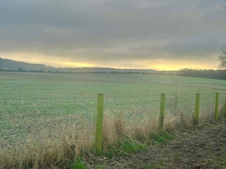
Thanks to Tracy for the photograph.
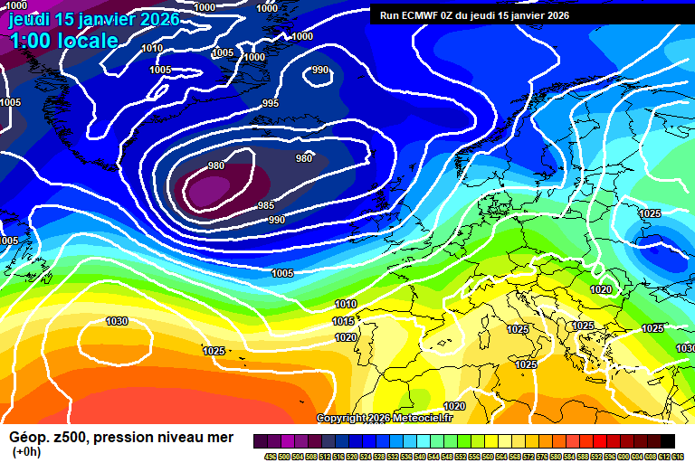
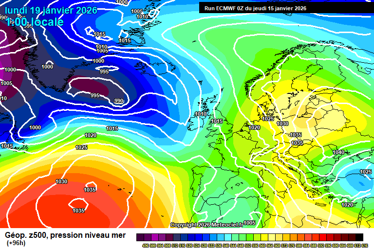
So the general set-up sees low pressure to the west heading our way, though high pressure over Siberia is going to head west, which will mean that the main low pressure sits over the UK during the weekend, and gradually fades, as it cannot move east.

Today starts cloudy. Outbreaks of often heavy rain will arrive any time from around 8/9am onwards, and will continue until mid-evening. A fair soaking ahead. Around 9’C, winds becoming quite gusty in the afternoon too. Skies gradually clearing somewhat once the rain clears mid, maybe late evening, some mist/fog possible in places – but one or two showers again possible before dawn. Down to around 3’C.
Friday will be brighter to an extent – still a fair amount of cloud around but there will be bright/sunny spells at times, more so in the afternoon. Showers possible, more so both first thing in the morning but possible any time of the day – they will be hit and miss, so an equal chance of staying dry as to catching one/two. Around 9’C and breezy. Fairly cloudy in the evening and overnight, and more in the way of showers around. 7’C or so.
By Saturday the low pressure is fading quickly – quite a lot of cloud around and some showery bits, but a fairly nothing day really, weather-wise. Around 9’C. Generally mostly cloudy overnight – there is a chance of some showery rain moving up from France, but low likelihood – say 20% chance.
Some uncertainty on details for Sunday, though the most likely outcome is a mostly cloudy day with some outbreaks of showery rain developing at some point. But it is quite finely balanced, and a cloudy but dry, or even a fairly sunny day is possible. Around 8’C.
By Monday we are kind of in battle ground scenario, with low pressure systems coming up against the high pressure block to our east, and the UK is roughly where the no entry sign is.

Again details from here are fairly uncertain, and will depend on where weather fronts stall.
For both Monday and Tuesday, the main weather fronts should remain to our west – but likely some showers/showery rain develops ahead of them at times, so generally the more likely outcome is fairly cloudy, occasionally bright/sunny, some showers/showery rain at times – but often dry.
Still around 9’C or so.
Highly uncertain for the rest of next week – maybe low pressure systems make more progress and we get some more rain for a time – but also maybe the high pressure block extends this far west, and we get drier and somewhat colder weather instead, with overnight frosts becoming possible once more, depending on cloud amounts.
There’s a reasonable chance that the week after (w/c 26th January) sees more of an easterly flow, with a return to below-average temperatures, and a chance of wintry showers depending on the exact set-up.
A very long way away, in meteorological terms, but there are fairly strong signals towards this considering it is 12+ days away.
I wouldn’t even rule out a Beast From The East type scenario. It’s within the range of plausible outcomes.
Have a jolly end to the week, I shall be back on Sunday morning, all being well.
Any comments?
No comments yet. Be the first to comment!