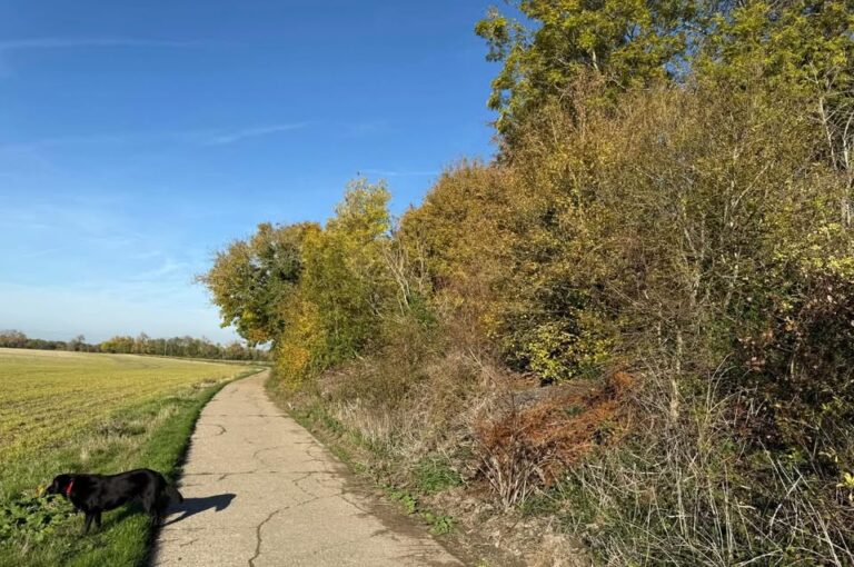
Lots more dry weather to come, not always sunny and perhaps a shower or two.
Thanks to Andy for the photograph – though please don’t expect this much sunshine.
All the seasonal models/forecasts were going for a wet November (my seasonal forecast did too), yet here we are entering November with a large area of high pressure over the UK.
Of course, it’s only the second day of November so it could easily end up being a really wet month, but certainly not the first 10 days – and I’d argue an average month in terms of rainfall is now more likely than a wet month.
You all know we are having a record-breaking El Niño – there is nothing to compare this to, so whilst a wet/very wet autumn was a reasonable guess, we only get secondary effects from El Niño (wet autumns are more likely than normal during El Niño but it isn’t guaranteed), and it seems the year-long desire for high pressure to build over the UK continues instead.
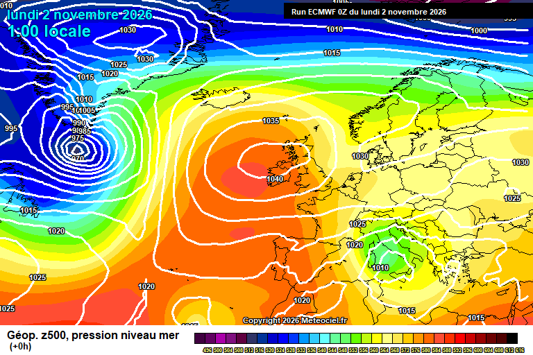
Today sees a mixture of sunny spells and cloudy spells, perhaps a brief shower – say a 25% chance. Feeling cool in the easterly breeze but getting to around 12’C. A mixutre of cloudy spells and clear spells overnight, down to around 7’C.
Tuesday sees a weather front poking into the south-east corner of the UK, so a greater chance of a few showers, though still questionable whethere they get this far inland. Otherwise probably more cloud than sunshine overall. Around 12’C, and still an easterly breeze. One or two showers still around in the evening but dry overnight with a mixture of cloudy and clear spells. Down to around 7’C.
Wednesday again is a mixture of cloudy spells and sunny spells, a small chance of a light shower but most likely it stays dry. The easterly breeze more notable, so feeling cool and around 11’C. Again a mixture of cloudy and clear spells overnight, though probably more in the way of cloud. Down to around 7’C.
Only subtle changes by Thursday, high pressure now centred to the east of Scotland, we still have the easterly breeze and a weak low pressure to the south of us.
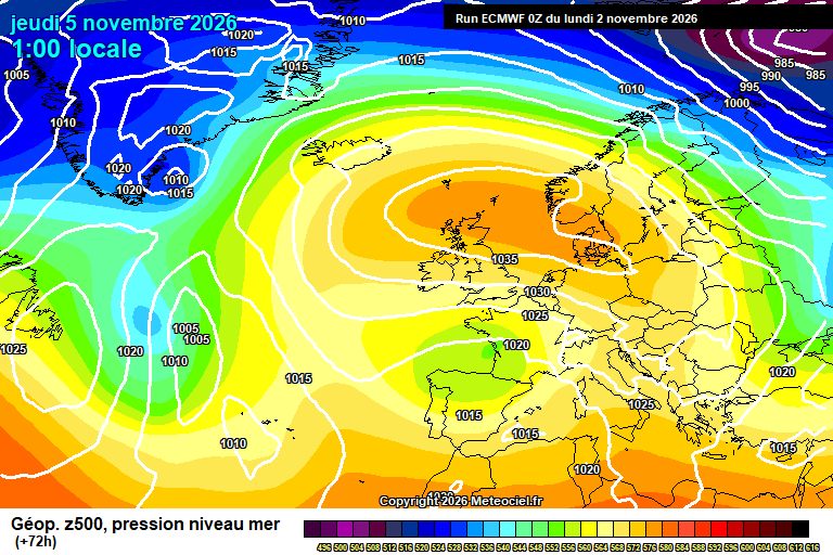
Again a mixture of cloudy spells and sunny spells, though probably on the cloudier side of the spectrum, if not mostly cloudy. Perhaps a spot of drizzle. Still pretty cool in the easterly wind – around 10’C or so. Uncertain on cloud amounts overnight – roughly down to around 5’C though give and take.
By Friday we lose the breeze, but otherwise it’s uncertain on cloud/sunshine amounts, anything from a totally sunny day to a totally cloudy day is possible – though I’d suggest the cloudier side of the spectrum is more likely. Around 11’C. Uncertain overnight – if the day was sunny then a cold and frosty night possible, fog possible also. If cloudy by day, then probably cloudy by night.
Saturday again uncertain on cloud/sunshine amounts though otherwise dry and around 11’C. Overnight fog possible.
Likewise for Sunday.
I think the week after low pressure tries to head up from the south-west – the trying bit seems likely, whether it makes it here and brings some rain/showers is uncertain. Milder conditions would ensue if it does, and probably windy at times.
The more likely outcome does see at least some rain/showers/wind through the middle part of November, but far from a done deal.
As I mentioned earlier, the super El Niño makes it harder to forecast long-range because it’s off the scale and there’s nothing to compare it to. But also there is a sudden stratospheric warming event likely – and one has never happened anywhere near as early in the autumn/winter season (would break records by 2-3 weeks). Not to mention recent SSW events haven’t behaved as we expect in terms of their impacts down here in the troposphere.
So it’s all very interesting ahead. But all very confusing.
Dry for now. Mostly. Next forecast should be on Thursday morning.
Any comments?
No comments yet. Be the first to comment!