
A changeable but not too bad few days ahead – though likely wetter and windier later in the week and into next weekend.
Thanks to Louise for the photograph.
So we start the forecast period with low pressure to the east and a chilly northerly flow, though this will become more westerly over the next few days.
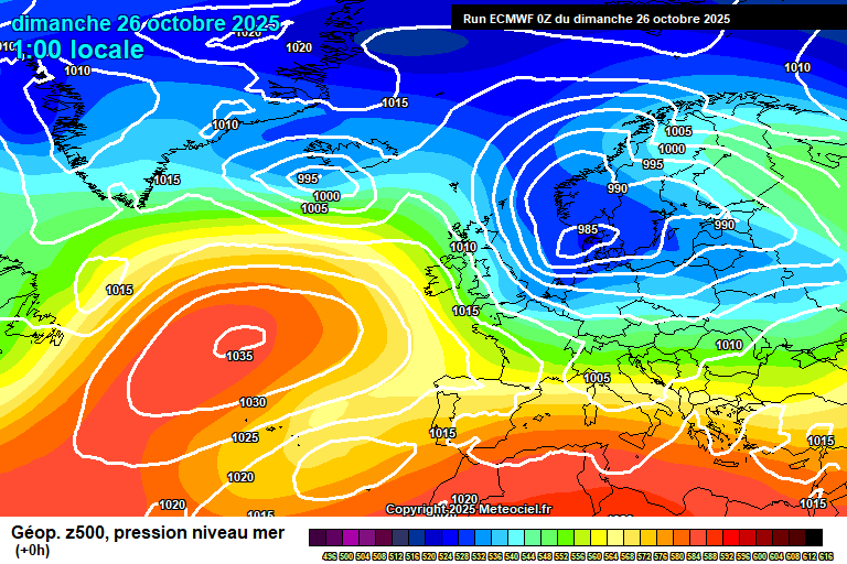
A sunny start to Sunday but cloud will increase from late morning onwards, with bits and pieces of mostly light rain during the afternoon and into early evening – though the odd heavy burst may be possible. Chilly for the time of year at 10’C and rather breezy. Still some bits of showery rain in the evening but this will clear south to leave clear spells overnight, down to around 8’C.
Monday looks a reasonable day, decent spells of sunshine, some cloud around – perhaps a shower or two through the early afternoon period. Windy in the morning, fading somewhat later, around 13’C. Mostly cloudy overnight – a weak weather front might give a bit of rain at times, but minimal amounts. Around 10’C and becoming quite windy again by dawn.
The overnight weather front might just hang on through sunrise on Tuesday, so a little showery rain possible if you are awake early enough, but this will quickly be replaced by sunny spells and fair weather cloud for the rest of the day. Around 14’C and breezy, perhaps quite windy in the morning. Cloud thickening overnight with rain possible later – but some uncertainty on the tracking of this. Around 10’C.
Some uncertainty for Wednesday as a weather front will be lying across England somewhere – arguably more likely across the south, which would mean outbreaks of rain at times during the day. But perhaps it’s further north, so a cloudy but dry day – at least until the weather front migrates south. Around 14’C – give or take.
By Thursday we see a new area of low pressure develop and head towards us.
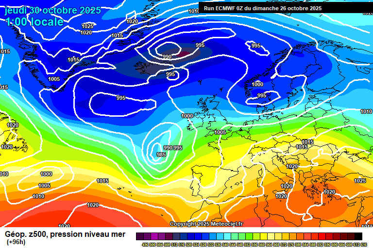
Again uncertainty on timing – rain will spread across either during Thursday day or night – if the latter (more likely) then Thursday itself will be dry with hazy sunshine, and gradually clouding over. Again, roughly around 14’C.
For Friday and into the weekend it will be more unsettled, with several spells of rain likely, though if the rain comes overnight (no idea yet) then day time wouldn’t be too bad. And temperatures on the mild side, say around 15’C – though there remains a small chance of something pleasant and quite warm, though we’d need a bit of luck on timing.
Of course, if the bands of rain arrive during daytime hours, then, well, mild rain.
Generally quite windy too – a chance of strong winds at times, but not able to have any confidence on that at this stage.
For the first 7 to 10 days of November, it’s likely low pressure will often be on the scene – so expect more wind and rain. But also mild/very mild – an unusually warm day or two for the time of year could easily sneak in.
After that, more likely high pressure takes control – so becoming dry and settled once more, though I suspect often cloudy with overnight fog very possible.
Early thoughts for winter, at least December and January would be for it to be broadly cloudier and drier than normal, probably milder than normal overall too. Maybe more unsettled in February.
Have a pleasant Sunday.
Any comments?
No comments yet. Be the first to comment!