Welcome to my summer weather forecast 2025 for Reading & Berkshire, though more or less it would apply to much of England, should you be reading from further away.
I’ll start with the usual caveat in that seasonal forecasting is impossible to get fully correct, a broad brush approach is the best we can do at the moment – and even then, meteorological events will change it.
Hopefully more is right than wrong, that is my aim.
My spring forecast was a pretty good guide, I was concerned that the very late sudden stratospheric warming event would cause some cold spells, but they didn’t transpire – otherwise there was lots of blocking highs to our north, plenty of sunshine, often warm – in fact record-breaking sunshine and warmth for the whole season.
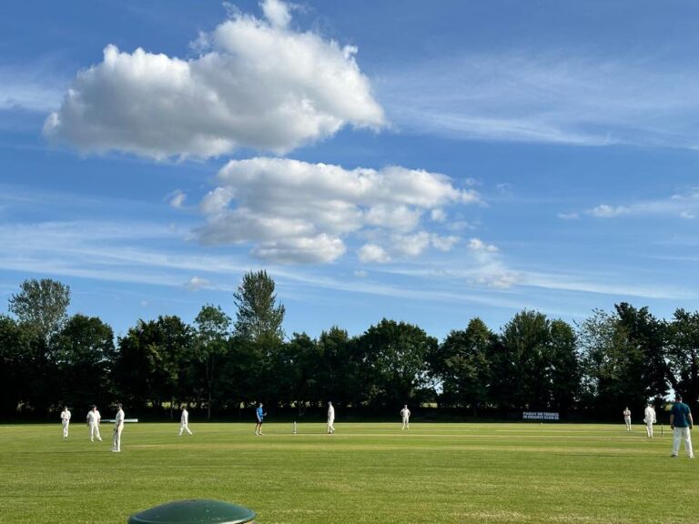
Also a quick thank you to Helen for the photograph – a charity donation will be sent when you let me know which. And also a thank you to those still sending them for the normal forecasts – they would be more boring without them.
Background Signals
Always less to go on in terms of background signals in summer.
The late sudden stratospheric warming (or very early final warming of the stratospheric vortex, which it is probably classed as) does tend to marry up with drier and hotter than normal summers following.
Well above-average sea surface temperatures should increase temperatures over the UK when we have high pressure, though may help to increase the jetstream strength when it is over us, due to the temperature contrast.
Likewise the dry ground due to the lack of rain since February, will increase temperatures when it is sunny, and likely also reduce cloud amounts.
Neither El Niño or La Niña are in play at the moment.
And that is all I can think of. Onto the expectations.
June
June starts somewhat unsettled, a couple of fine days but more days will see at least some showers or rain – breezy/windy at times too, and cooler than normal.
From week 2 it should warm up, still the chance of some showers on some days, but also a chance of some short very warm/hot spells too.
High pressure should build more broadly from around mid-month to bring much more in the way of dry, warm and sunny days – probably quite hot some days, some cloudy starts possible though depending on wind directions.
Perhaps a greater chance of showers at the very end of the month.
Overall I expect above-average temperatures, somewhat above-average sunshine, and rainfall amounts slightly below-average – unless you get a notable downpour.
Confidence level around 75%.
July
Fairly weak signals for July, though there is a fairly consistent but weak suggestion for high pressure to be close to the UK – positioning will be key, as always.
To start the month, there is a greater chance than normal of some heavy showers/thunderstorms, but also some very warm/hot sunshine too.
My semi-educated guess is that it will settle down more broadly for much of the rest of the month, with high pressure in control, and plenty of very warm/hot sunshine.
Temperatures and the chances of thundery outbreaks will depend on the positioning of high pressure, there is some suggestion this could be close to our east which could put us in a loop of short hot/very hot spells followed by significant thundery breakdowns – but this is very low confidence this far out. There are other suggestions that high pressure is more likely positioned over the UK, or even slightly to the north which would reduce thundery outbreak chances, and keep things more normal (still very warm/hot) in terms of temperatures.
Overall I expect above-average temperatures, above-average sunshine – rainfall amounts could be anything compared to average, depending on if you get some particularly heavy downpours on the showery days.
Confidence level around 70%.
August
Less confidence for August, which should be no surprise as it is two months away (and normally the start of hurricane season which can cause changes in weather patterns for us) – however there remain signals for high pressure to be close to the UK.
So my assumption is that there will more dry, sunny and very warm/hot weather for much of the month – though how hot will depend on where high pressure is positioned.
Certainly a chance of some afternoon downpours developing on some days – I’d suggest later in the month more likely, though if high pressure is to our east, then there is a chance of going into a loop of short hot/very hot spells followed by thundery breakdowns.
Overall I expect above-average temperatures, above-average sunshine amounts, and rainfall – well, less days of rain than normal, but amounts will depend on whether you get some notable downpours.
Confidence level around 60%.
Summery And Early Autumn Thoughts
So, I’m suggesting a sunnier and hotter summer is more likely than not. To use one of those modern phrases, it could be a summer for the ages.
If we find out in 3 month’s time that it was the hottest and/or sunniest summer on record, or close to, then I would not be surprised.
However, the last time I stuck my neck out and predicted such a summer, it didn’t happen…so as always, take it with a teapot of salt.
There’s no particular compelling signals for autumn, early suggestions for September seem fairly mixed, hints of a drier than normal October/November.
Have a great summer! I think I’ll save my holiday time off (and holiday money) for later in the year.
Any comments?
No comments yet. Be the first to comment!