After a proper soaking yesterday, its time for things to gradually somewhat drier and a bit colder.
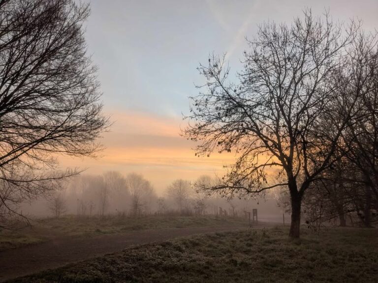
Thanks to Phillipa for the photograph.
So the general set-up right now sees us remain in the westerly flow, though not for long.
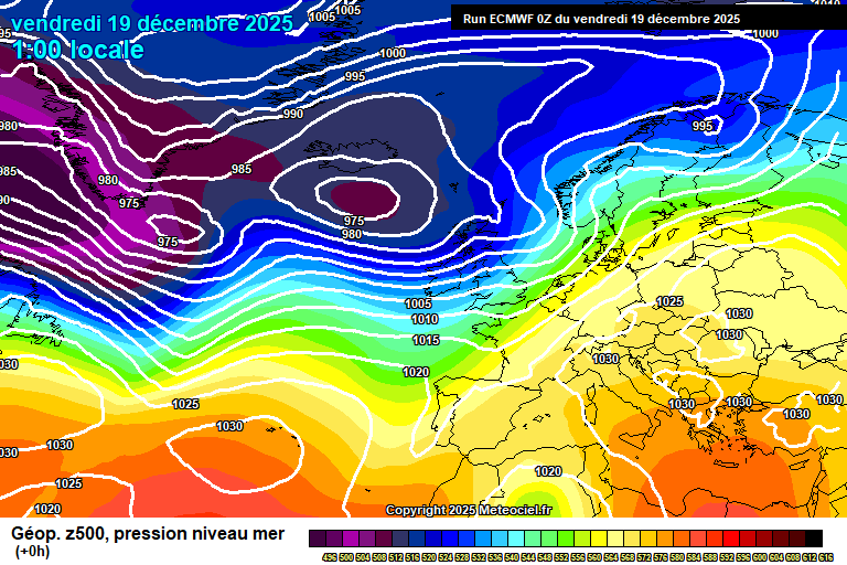
Today will be mostly sunny. A bit of cloud around at times, a bit of high cloud around at first – but a very pleasant December day otherwise. Around 10’C though still breezy. Reasonably clear skies overnight, down to around 3’C – a small chance of some fog patches forming by dawn.
Saturday looks a reasonable day, once any fog patches have cleared. Reasonable amounts of sunshine, some cloud possible at times and a 25% chance of a shower drifting up from the south. Around 9’C. Cloud thickening overnight with some bits of showery rain, still around 9’C.
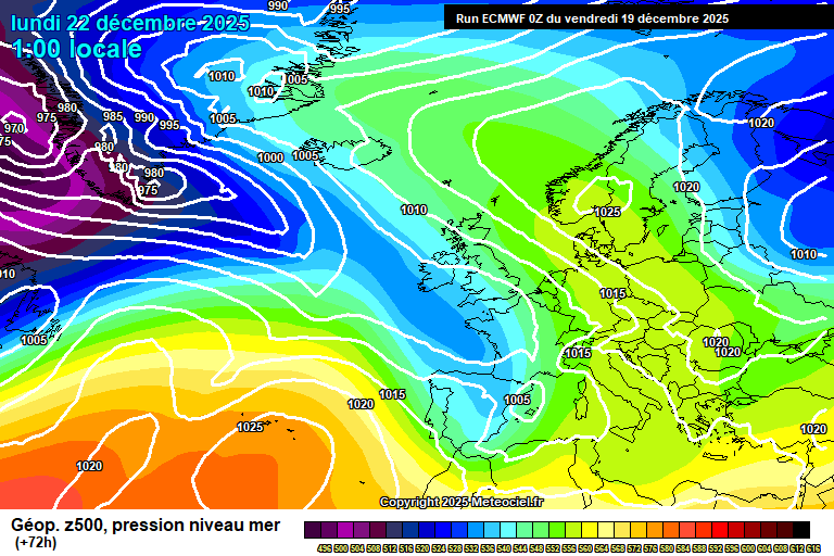
Sunday sees a decaying low pressure over the UK – generally cloudy with some showery rain at times. Around 10’C. The rain probably more persistent in the evening and the first part of the night, though some uncertainty on this, breezy too. Still around 10’C.
By Monday we start to see high pressure building over Scandinavia, and also attempting to build to the west over the Atlantic – which starts to push our low pressure down into Europe.
Generally we’ll be looking at a cloudy or often cloudy day, with some bits of light rain possible. Around 10’C or so. Probably cloudy overnight, some light rain again possible, around 7’C.
For Tuesday the wind starts to swing to a more easterly (ish) direction, so feeling cooler. Uncertain on cloud amounts – it could be a sunny day, it could be a cloudy day (with some light rain) – or somewhere in between. Cloudy seems more likely though. Around 7’C, give or take. Probably cloudy overnight with some light rain possible, around 5’C.
The more likely outcome for Christmas Eve is an easterly flow, cloud more likely than sunshine and temperatures around 6’C – though feeling colder in the chilly wind. If the cloud clears overnight, a frost will be possible.
For Christmas Day itself, probably we are in an easterly flow.
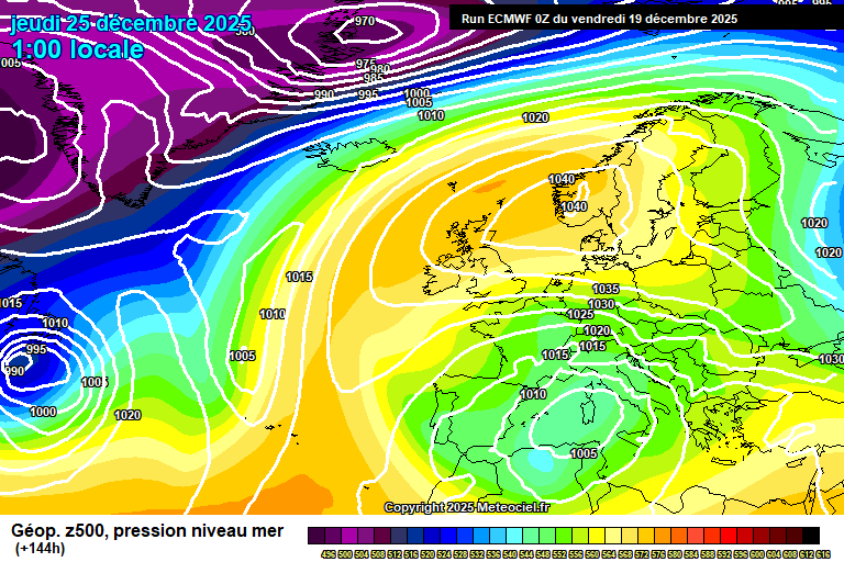
Uncertain on cloud/sunshine amounts at this stage, though it will feel fairly cold at around 5’C and in that easterly wind.
I still cannot totally rule out a White Christmas, the positioning of the high pressure remains subject to change, and it plausibly could orientate itself a bit further north, which could allow for some wintry showers – say a 7% chance now.
High pressure likely remains close by between Christmas and New Year, probably even into the first week of January, which means generally it should be on the cold side of the spectrum, overnight frosts very possible (assuming a lack of cloud), fog possible – sunshine/cloud amounts uncertain.
Very possible again that high pressure could orientate itself to allow for some wintry showers from the east at some point, or low pressure systems from the west could push up against colder air and bring some snow or rain/snow mix during this period. Impossible to say at this stage…but do keep an eye on the forecasts if you have travel plans after Christmas (and try to ignore the clickbait articles).
Have a good weekend, the next forecast will probably be on Tuesday morning, maybe on Monday, we’ll see.
Any comments?
No comments yet. Be the first to comment!